![]()
|
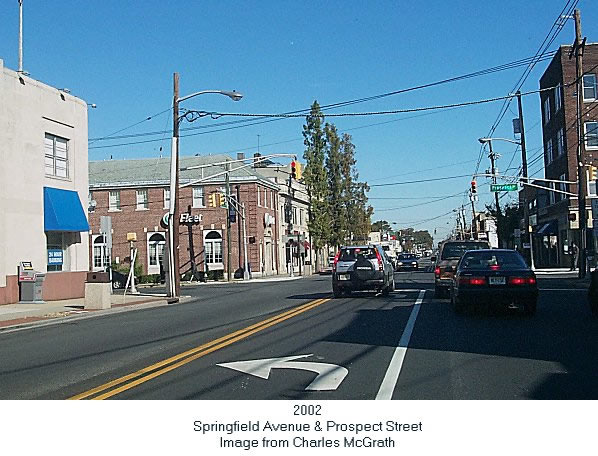
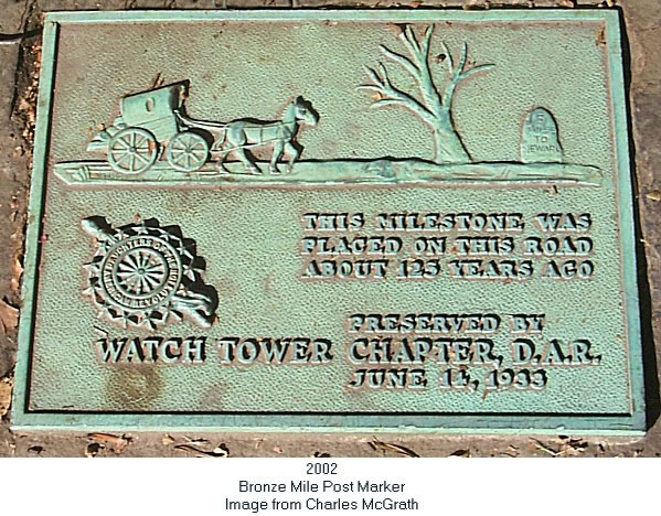
From Charles McGrath: The Newark /Morristown Turnpike was built in circa 1808 A.D. We know it today as Springfield Avenue. Many of our original roads were Indian paths. They went in every direction except straight. The turnpikes didn't go around obstacles but rather through them. The turnpike began at the intersection of Springfield and South Orange Avenues ( Kearn's Corner ). It had tolls not unlike our turnpikes of today. The first toll leaving Newark was near Bergen Street. See the attached photo as it is today and also the 1850 map in the Map section of this site. Every mile was posted with a stone mile marker. The "5 miles to Newark " marker was originally located on Springfield Avenue and Prospect Street in Maplewood. The D. A. R. moved it in 1933 east on Springfield Avenue to the area in front of the Maplewood Library. They took this action to save it from construction or from destruction as the case may be.. bronze marker photo. It was inscribed "5 miles to Newark". Twelve years ago there was the only mile marker left. It was defaced and only the letter N of Newark remained. Mary Lou McGrath contacted the local officials to have it preserved. They moved it into the library and replaced it with a facsimile. See the attached photos. Thanks to her efforts we can enjoy a look at our past. Wards
Enumerations Districts
The Neighborhood
|
||||||||||||||||||||||||||||||||||||||||||||||||||||
 |
Copyright 1998 - 2025 Glenn G. Geisheimer |